


Crossing the Rhine was only the first phase of Operation Flashpoint, once a bridgehead set up on the east bank of the river and towns in the area liberated, it was necessary to push back the enemy toward the east, further in the heart of the Germany. By that time it was “The Closing of the Ruhr Pocket”.
Back in August 1944, German army was surrounded by the Allied Forces during the Closing of the Falaise – Chambois pocket, ironically it became a habit for them to be surrounded as the same scenario was repeating itself.
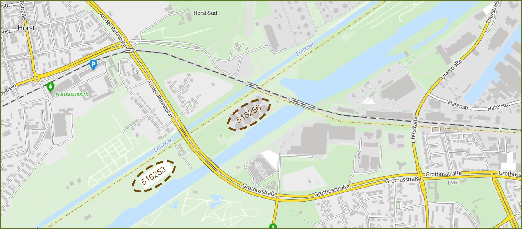
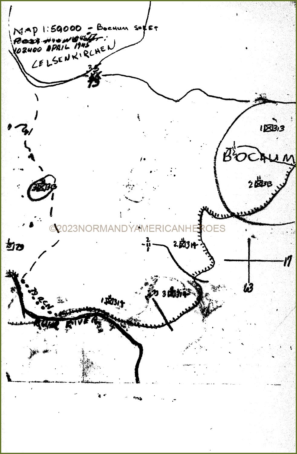
April 6th, 1945, 1st Battalion of the 313th Infantry Regiment of the 79th Infantry Division was in position in the vicinity of Horst, a town north of the Neue Emscher and Rhine-Herne Canals and also North of Essen. The plan of attack was to have them entering the Ruhr pocket by crossing the two canals and assaulting the enemy from the north while the 1st US Army units drive up from the south. Crossing over the two water barriers into the Ruhr pocket involved bridging both canals.
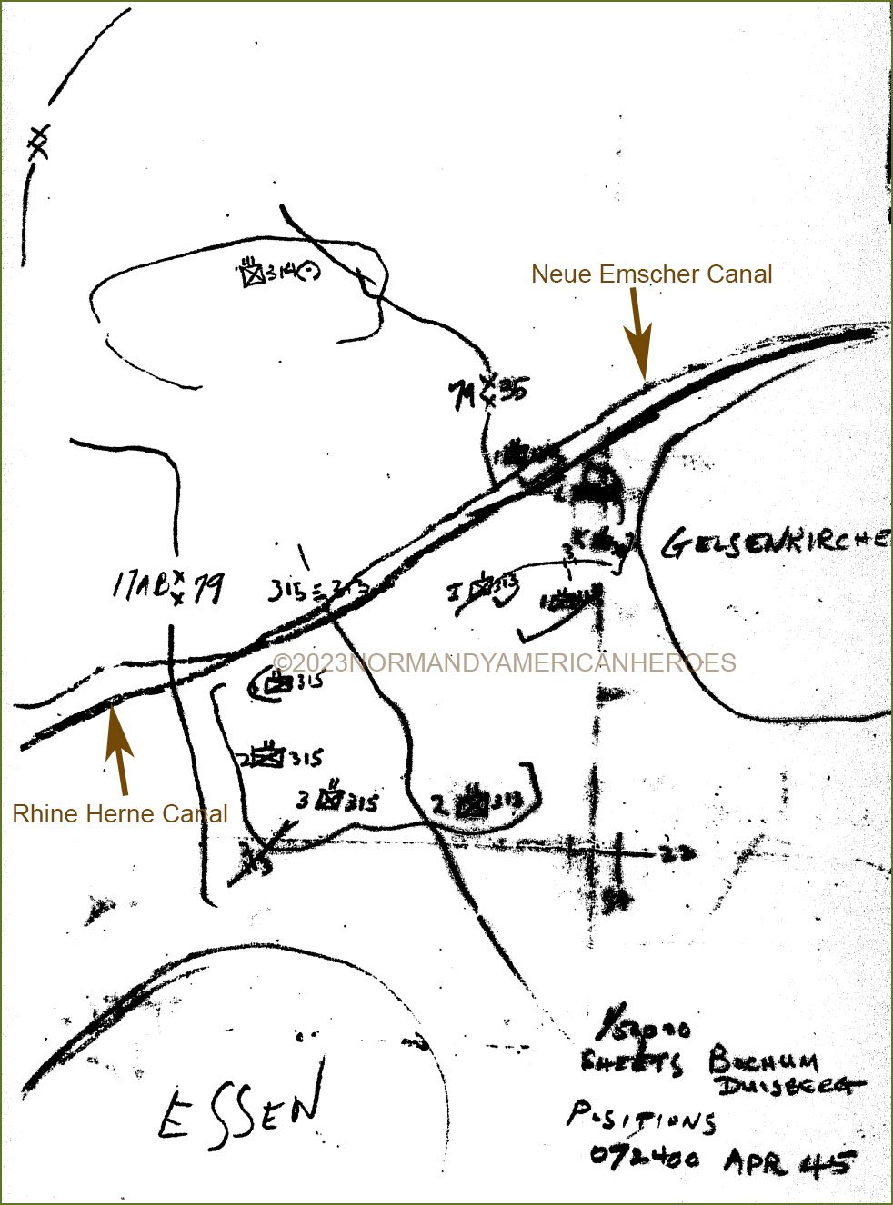
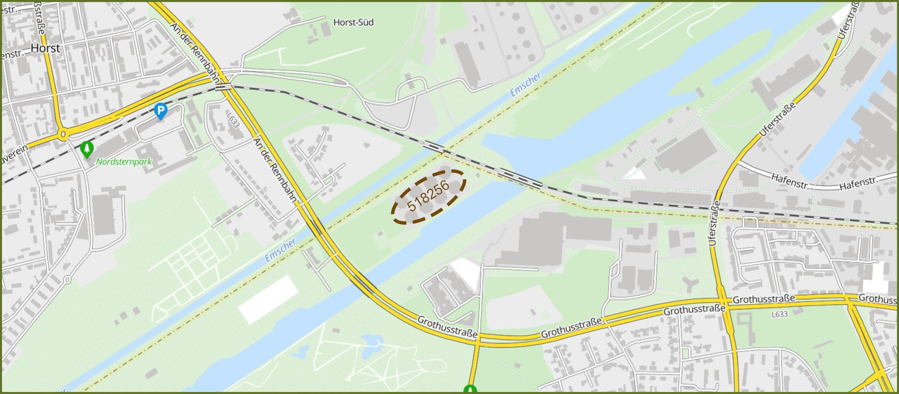
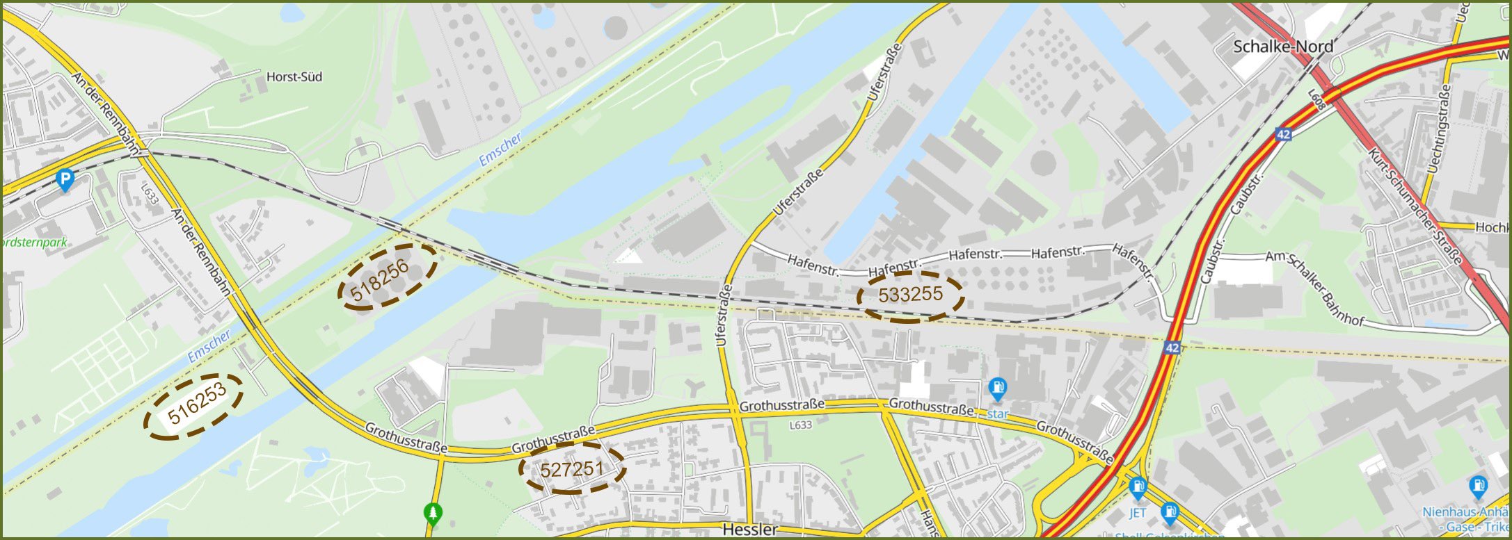
Neue Emscher Canal was much narrower than the Rhine-Herne Canal and both were separated by 150 yards of factory area. Germans trapped in the pocket found shelter and used the factories as strongpoints. Lieutenant-Colonel William A. Hylton commanding the battalion, on the afternoon of the day went down to the island between the two canals at coordinates 518256 (see map below) to inspect the crossing site that his men were to use.
Once there he testified that he was amazed of the work already down by the engineers, thirty lined up boats waited just to be used. Of course, all of this was made under the eyes of the enemy, especially the ones of the front observers who would direct fire as soon as one American soldier would be inside one of these boats. As the risk was to high, Lieutenant-Colonel Hylton refused to use those boats and preferred to employ a foot-bridge to cross the Rhine-Herne Canal 250 yards away.
 ©2023MichelinMap
The foot-bridge was built up by 1st Platoon of “A” Company of the 304th Engineer Combat Battalion under the command of 1st Lieutenant Crowley (AAR Spelling) immediately after the reconnaissance mission of Lieutenant-Colonel Hylton. Location was not chosen by the engineers but by the Lieutenant-Colonel at coordinates 516253 (see map below).
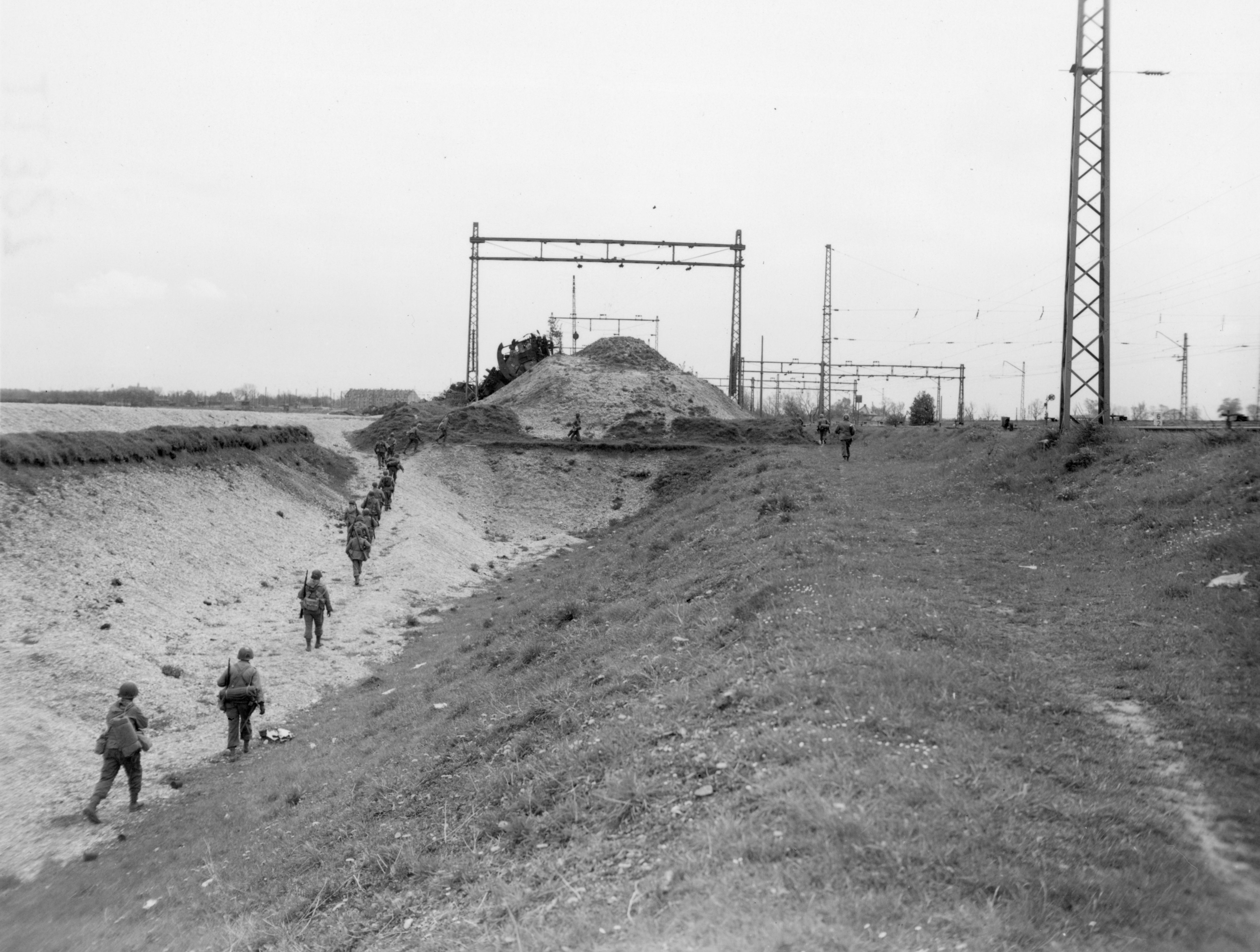
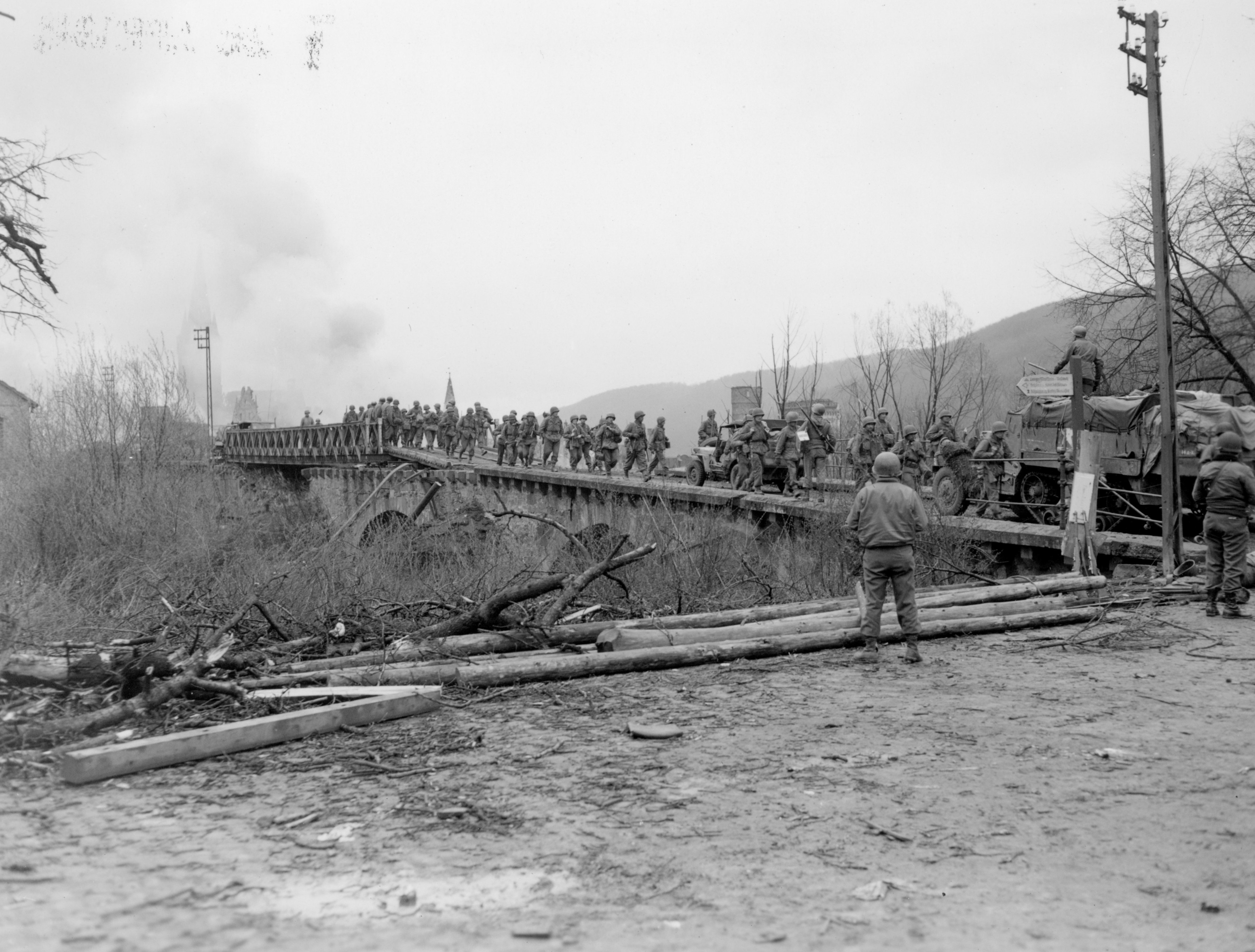 US soldiers crossing a foot-bridge in Germany.
By 0245am it was done. In the meantime, the artillery barrage began, lasted for fifteen minutes and was very effective. One-thousand rounds were fired by the motor platoon of the 310th Field Artillery Battalion attached to the 1st Battalion in the very small area, no need to say that no enemy resistance was encountered during the crossing.
 ©2023MichelinMap
First element of the battalion to cross the Rhine-Herne Canal was “A” Company at 0300am on April 7th, followed by “C” Company. Both companies worked together in attacking their objective which was at coordinates 533255 (see map below). The mission was a success indeed, but because of darkness “A” and “C” Companies didn’t notice they by-passed next to an enemy strongpoint at coordinates 527251 (see map below) with two-hundred and fifty men north and west of their objective. That event would cause problems for “B” Company, initially in reserve it was brought into action once “A” and “C” had crossed. Once in the area, “B” Company's men encountered that line of enemy defense.
 ©2023MichelinMap
Taking position on a line running from coordinates 539256 to 527243 at 0460pm on April 7th, “A” Company (on the left so north) and “C” Company (on the right so west) were on their first gained line during the second part of Operation Flashpoint.
For “B” Company its was another story as you are aware now, the line of defense they met was composed of factories that Germans had very well fortified, which defined perfectly the landscape of the industrial Ruhr area. Attacking those factories would have been extremely costly and an attempt to dig out the Germans one by one would have been suicidal. Instead, men were ordered by Lieutenant-Colonel Hylton to contain it. He wanted to wait for the support of tanks which had to come up the next day April 8th, to blast the buildings. Throughout the 7th, men from three companies scouted the area around the factories to find a way to take them down.
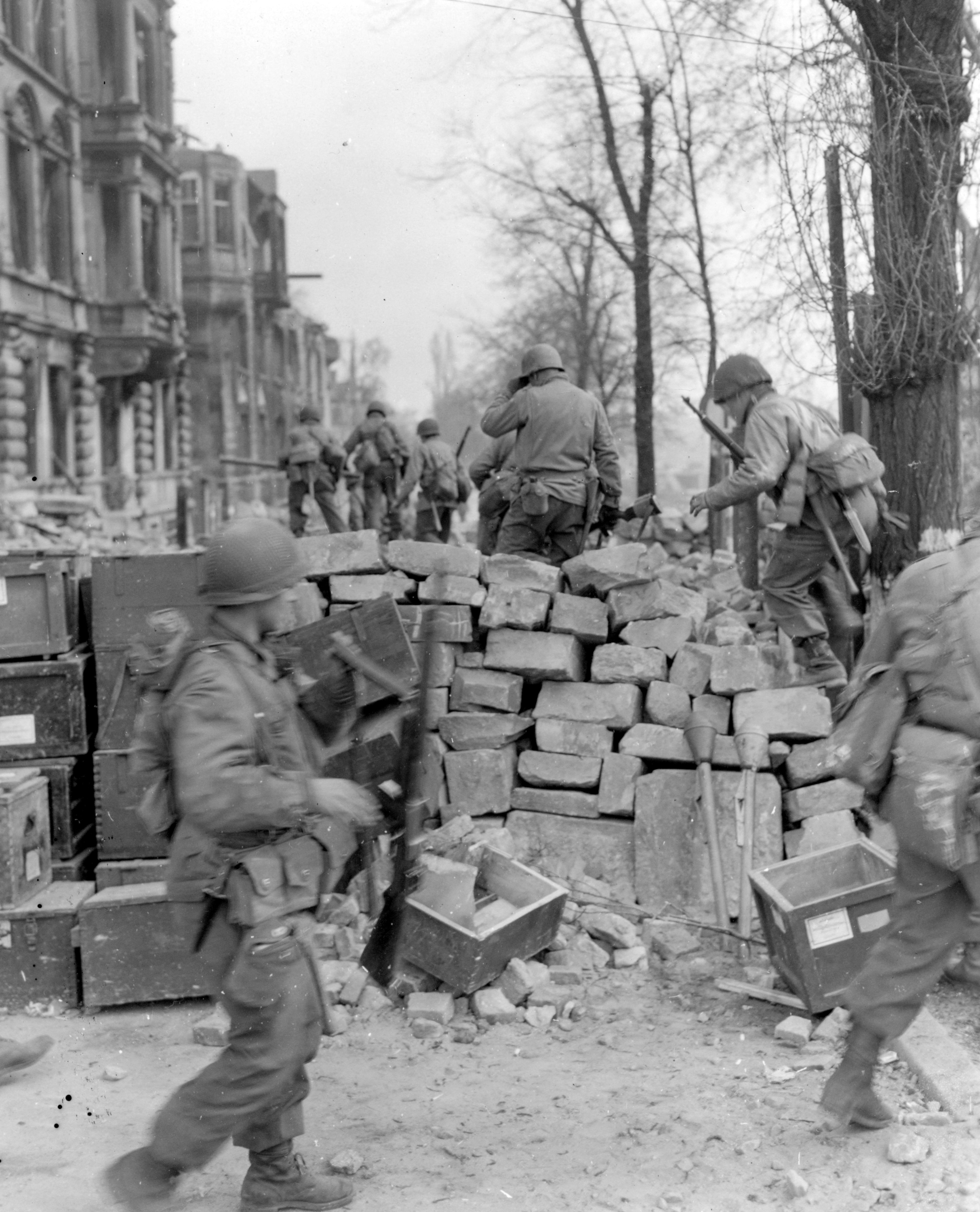
 US soldiers scouting a factory area in Germany.
Note: Tanks were from 1st Platoon of “C” Company of the 813th Tank Destroyer Battalion, and the 1st Platoon of “A” Company of the 717th Tank Battalion.
In the early hours of April 8th, motor platoon attached to the 1st Battalion changed its coordinates of fire and fired one-hundred and eighty shells on the factories at coordinates 527251 (see map above).Combined with the artillery shelling, men fired bazooka and automatic weapon fire upon the buildings. By doing that according to Lieutenant-Colonel Hylton, his troops and Germans started to play a child game of “Cops and robbers”.
Lieutenant-Colonel Hylton statement: "Of course, the game was deadly serious but as I look back on it now, it seems extremely humorous. An individual German soldier or a small group would dash out of one factory, turn in the corner and head for another. Behind him or them would follow groups of my soldiers in hot pursuit".
1st Battalion was winning the “game” and at 0945am the enemy in the factories surrendered, about one-hundred and fifty prisoners were made. The tanks which had to be in support of the attack came too late and showed up at 1000am. One hour and a half later, “B” Company spearheaded the attack toward the south between “A” and “C” Companies toward the new objective of the battalion which was at coordinates 546212, 4 miles south from the line of departure.
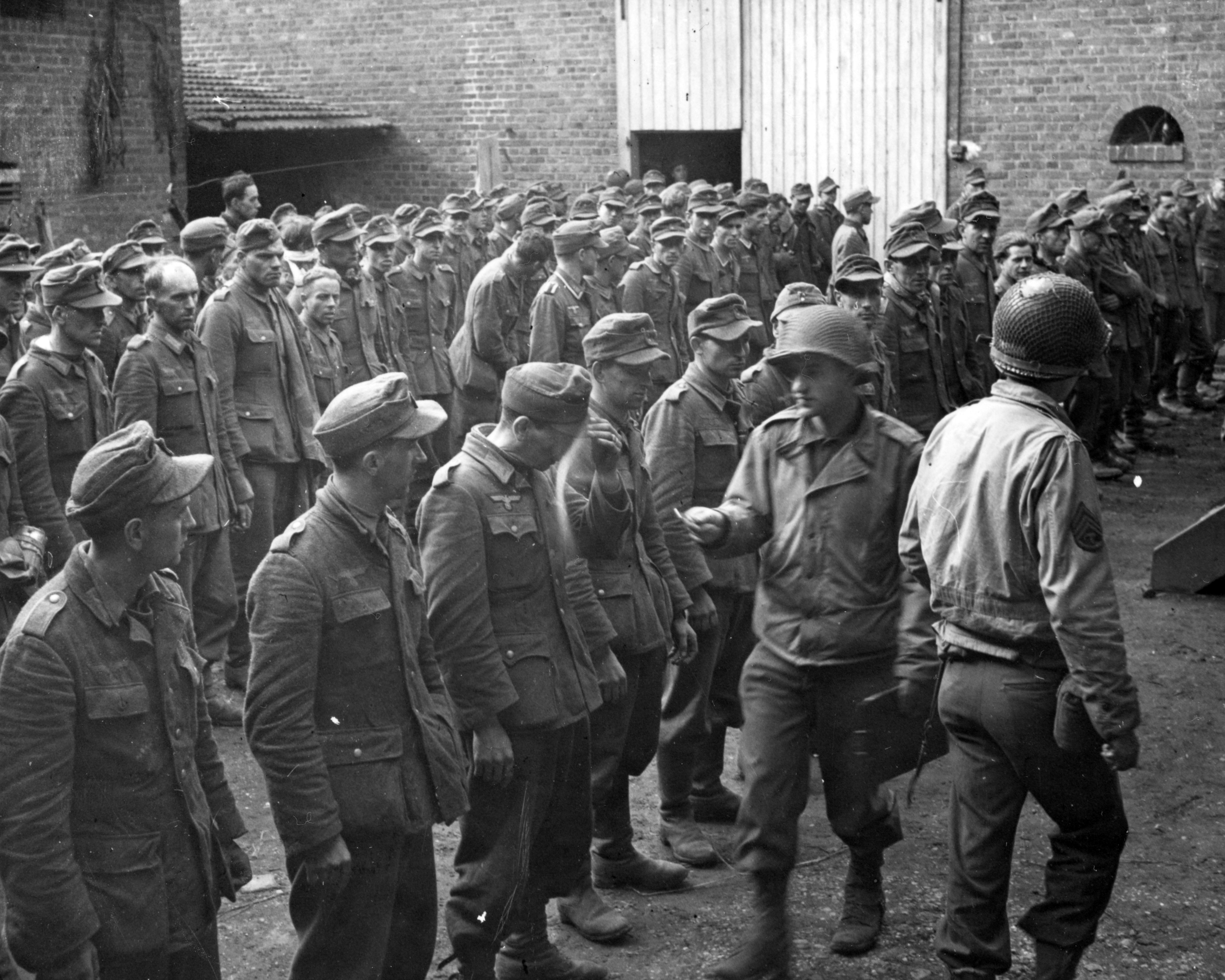 German prisoners.
Lieutenant-Colonel Hylton ordered his men to move as fast as possible to keep their formation in a column of companies (“B” leading, “A” in the middle and “C” at the rear) and to not move to the west or east as soon as they could have seen the enemy trying to surrender. In fact the tanks were leading the advance of the 1st Battalion and once an enemy would be in their path, tanks will charge toward him or them.
Lieutenant-Colonel Hylton statement: "That action usually resulted in one of two things: the enemy took off across the fields or else surrendered. We moved rather slowly but cautiously and by 0330pm, we were on our objective and had incurred no casualties but had picked up at least one-hundred prisoners".
“B” Company’s commander complained during the all day as a great number of scattered Germans showed up everywhere around him and it was impossible to make them prisoners as he had orders. The line of consolidation, through the night of the 8th of April, placed “B” Company circling the objective on the south, “A” Company on the north or left of “B” Company and “C” Company on the left of “A” Company or the furthest north, making contact with the 3rd Battalion which held the line facing east into Gelsenkirchen and north to the Rhine-Herne Canal.
 Positions of the 79th Infantry Division on April 8th, 1945.
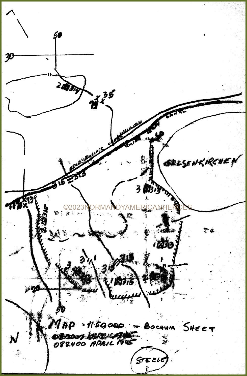
The next day, on the 9th of April, “C” Company maintained its position while “A” Company moved down and occupied a good point of observation which was on a hill at coordinates 551205 (see map below). During the night of the 8th to the 9th of April, “B” Company sent a patrol to scout out the situation on the hill and learned that it was very lightly held, thus “A” Company went and took position on it by 0930am on April 9th.
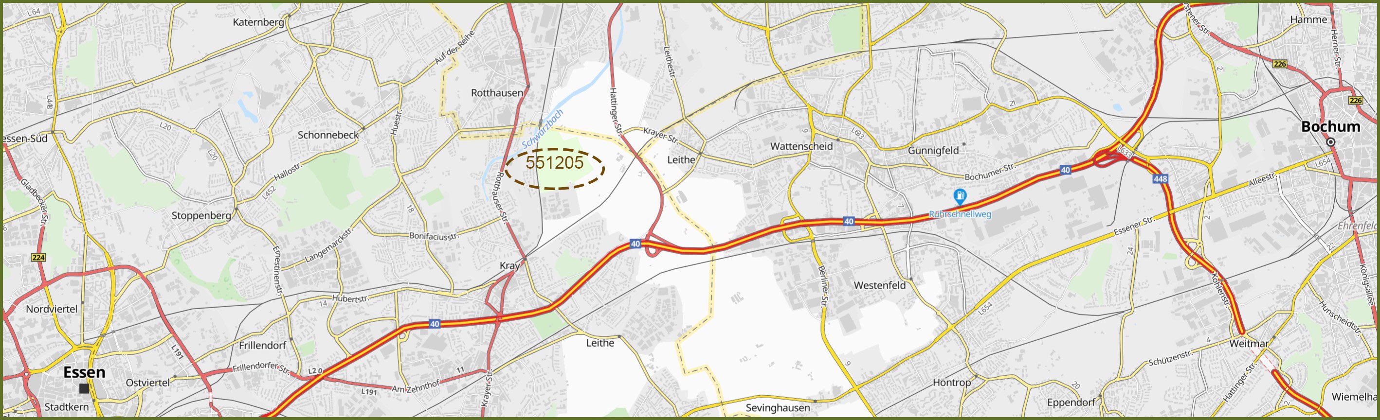 ©2023MichelinMap
On the same day, little infantry advance was made. “B” Company was placed in reserve while “C” Company patrolled an area approximately 1000 yards to the east of their frontlines. Artillery and mortars used “A” Company’s hill as an observation point, firing on known and observed enemy positions that lay to the east approximately 1200 to 1500 yards. Well, men were making preparations for their long drive to the east to Bochum on April 10th.
During the shelling two Germans came out from their emplacement to surrender, Lieutenant-Colonel Hylton told them he would not accept them and they were to go back with the twenty others and to come back all together. If they did not, 1st Battalion will wiped them out. Couple of seconds later twenty Germans came out from their emplacements as prisoners.
The following day April 10th , men moved off for the town of Bochum in a same formation as the previous day at 0800am with the 1st Platoon of “D” Company of the 717th Tank Battalion in lead. Men enjoyed to walk along the highway as the weather was sunny. First contact with the enemy was made at 1030am in the vicinity of coordinates 606235, quickly those men were put out of action, but upon reaching coordinates 620221 an extremely roadblock has been set up by the Germans.
On both sides of the enemy roadblock there were open fields, Germans knew if they would have tried to escape they would have been wiped out by US machine guns, their only solution was to fight and they did fight. This enemy force was made of sixty or seventy men armed with machine guns and a large number of panzerfaust. As the feeling that the German army was on run and that the end of the war was near, no men was sent to assault the obstacle and no risk was taken. Although an artillery barrage was laid on the enemy position killing twenty-five of the defenders, 1st Battalion’s men then finished the job at 1245pm. Walking to the east and couple of minutes after this little skirmish, three companies stopped for dinner and took a rest.
 US Troops straddling a German roadblock.
Once back on the road toward Bochum another enemy roadblock set up at coordinates 633244 stopped the advance of the battalion. This one gave them a little trouble. The battalion pushed past it where they have been held for a short time and engaged in a fire fight. “C” Company turned southeast and went in town while “A” and “B” continued on their way to the east. Both companies once in town, found nothing except rubbles.
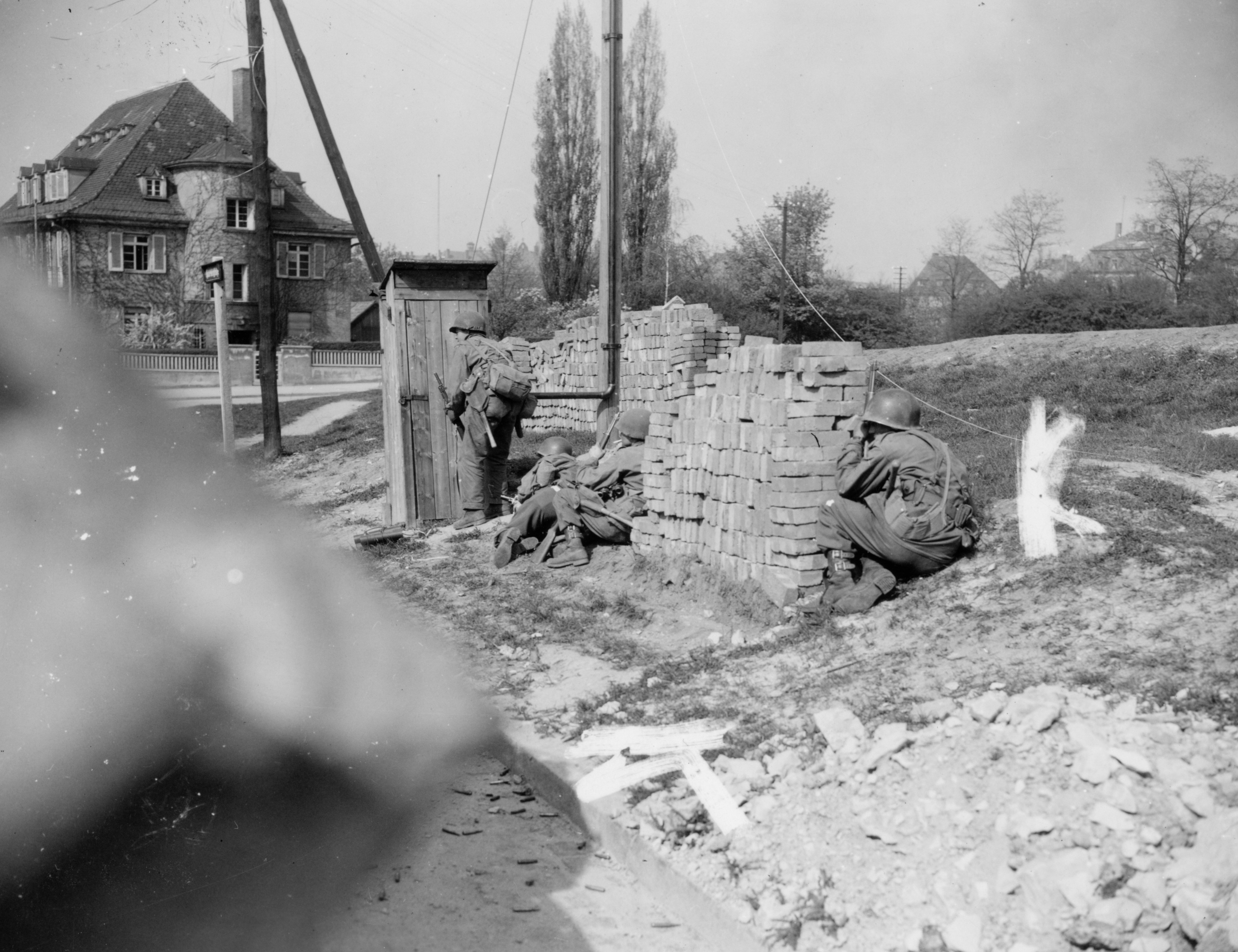 US Troops taking cover in Germany.
Men of “C” found out some enemy troops trying to escape toward the north, those enemy soldiers had been chased by the 2nd Battalion of the regiment. Knowing they were trapped in town, they tried to fight with their remaining vehicles and weapons their way out. This desperate escape was short-lived when one US tank knocked out one enemy vehicle, those Germans that were in the other vehicles and ones on foot, soon realized the hopelessness of their condition and at least fifty of them surrendered.
By 0400pm the 1st Battalion had reached its objective which was the western edge of Bochum and began to consolidate positions when new orders were received to continue the attack to the east. Men advanced about 1000 yards, when word came saying that the orders had been rescinded, men then tied in to the 2nd Battalion on the south. The line held that night was with “B” Company on the north and “C” Company on the south from coordinates 648223 to coordinates 645207.
 Positions of the 79th Infantry Division on April 10th, 1945.
On April 11th, 1st Battalion was relieved by the 35th Infantry Division which took over Bochum but as men were uncovered the entire battalion was loaded up in two and half trucks and drove rapidly to the west in the vicinity of Steele. The line of departure that men had in Steele was located at the southwest of the town, precisely 1000 yards at the southwest.
The final of objective was the town of Kettwig. Moving up once again in column of companies with tanks opening the road men followed the highway at coordinates 488149, 1500 yards away of Kettwig. No enemy position was encountered for 4 miles until they reached the vicinity of coordinates 451107. There, men were exposed on a high ground under enemy observation from the south of the Ruhr River who fired between forty and fifty shells. Hopefully no casualties were accounted for. Being under enemy artillery fire, Lieutenant-Colonel Hylton decided to continue on its away of advance along the highway where at coordinates 448102 a stranger came to meet him.
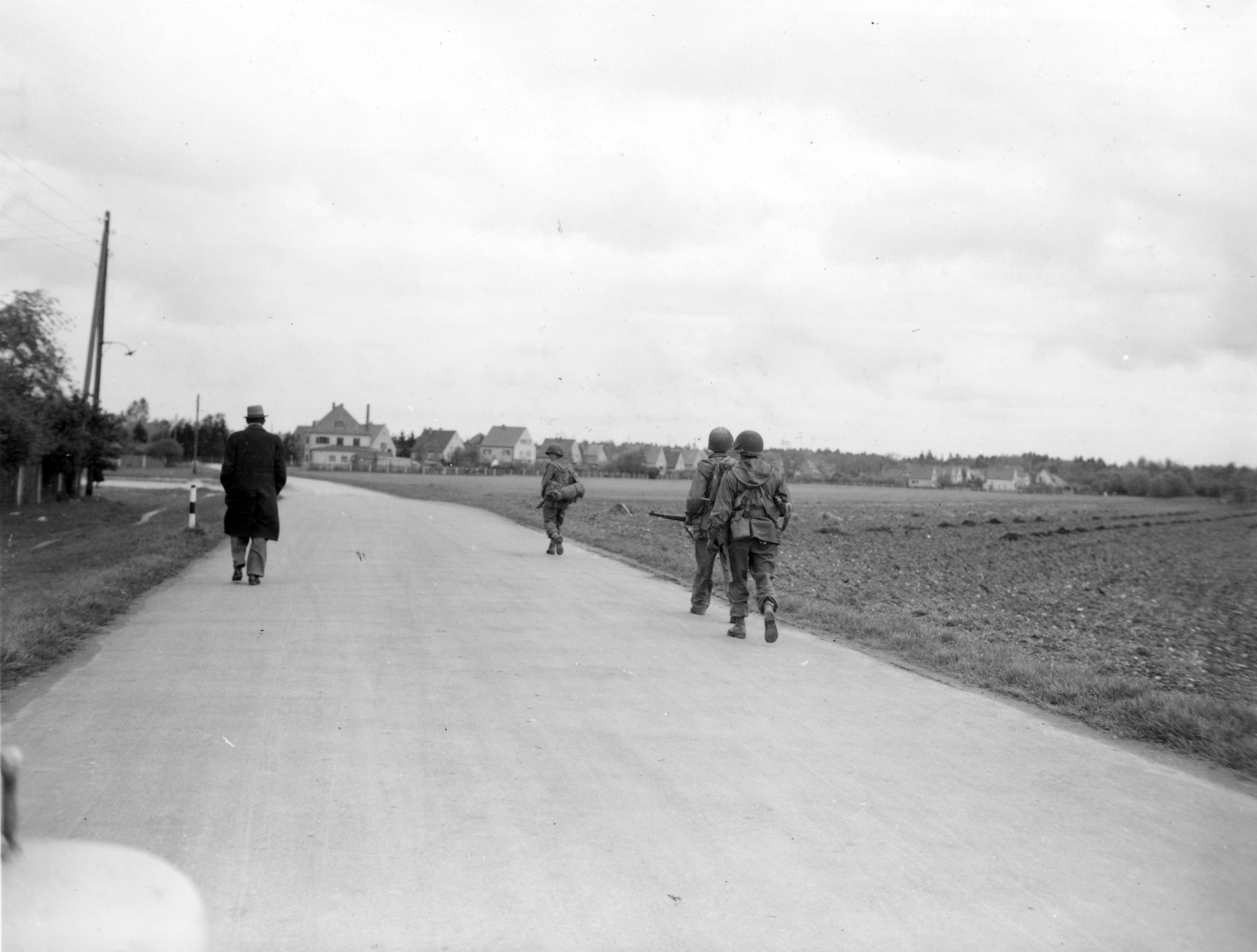 US soldiers walking on a road somewhere in Germany with a civilian.
This man was the Burgermeister (Mayor) of Kettwig and offered to surrender his city. He stated that the town was empty of enemy soldiers and thought that bridges over the Ruhr River have been mined by the Germans. At that point “A” Company in lead and “B” Company following and “C” behind left the highway, being in the outskirts of the town, at 0500pm civilians came up to meet their liberators from the Nazis. Captain Orville B. Paker led his company as quick as possible to one bridge, his 3rd Platoon commanded by 2nd Lieutenant Earnest H. Bishop went across it first but German artillery woke up.
Written by Pierre Fallet - Normandy American Heroes.